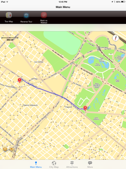
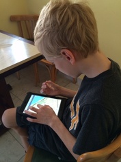
 Alex plots the route to the Zoo
 During the fall, I relied heavily on a large, cumbersome paper map to get around the city. Buenos Aires Map and Walks offers an excellent alternative, and this time around, I am taking advantage!
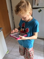
Although this app offers some pre-set walking tours, my main interest was the ability to have all of Buenos Aires in the palm of my hand at any given time for free-navigation. I decided to load this app on both my Smart Phone and the boys' iPads, in order to do some authentic mapping exercises as part of our Social Studies program.
I was very impressed with this app's capabilities and versatility. First of all, the maze of one-way streets that is a hallmark of BsAs navigation is clearly marked on the map. Secondly, you can zoom in and out and move around quite easily on the map. Perhaps most importantly, you don't need to be online to use the map!
 Simon finds our apt.
 The boys both quickly found our apartment and marked it as a set location that could be used as a starting or ending point for later "custom tours".
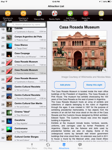
For those new to the city, Buenos Aires Map and Walks offers a starting point for tourist attractions. Users can select from a pre-set list of walking tours covering everything from "Children" to "Art and Culture" to "Gay Attractions". Although not comprehensive (We would have added the science ctre, the Natural Science Museum and the Cebra toy shop on Scalabrini Ortiz to the children's attractions, for example!), the tours offer a nice intro to the city. Each stop on the tour is marked on the map, and if you click on one of the sights, a photo with a detailed description of the sight pops up. (Users can also add their own photos, and even "stamp" the site once they have visited it.) Tours range from 2 - 4 hours.
For those new to the city, Buenos Aires Map and Walks offers a starting point for tourist attractions. Users can select from a pre-set list of walking tours covering everything from "Children" to "Art and Culture" to "Gay Attractions". Although not comprehensive (We would have added the science ctre, the Natural Science Museum and the Cebra toy shop on Scalabrini Ortiz to the children's attractions, for example!), the tours offer a nice intro to the city. Each stop on the tour is marked on the map, and if you click on one of the sights, a photo with a detailed description of the sight pops up. (Users can also add their own photos, and even "stamp" the site once they have visited it.) Tours range from 2 - 4 hours.
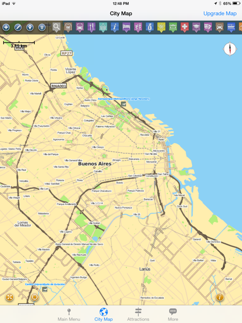

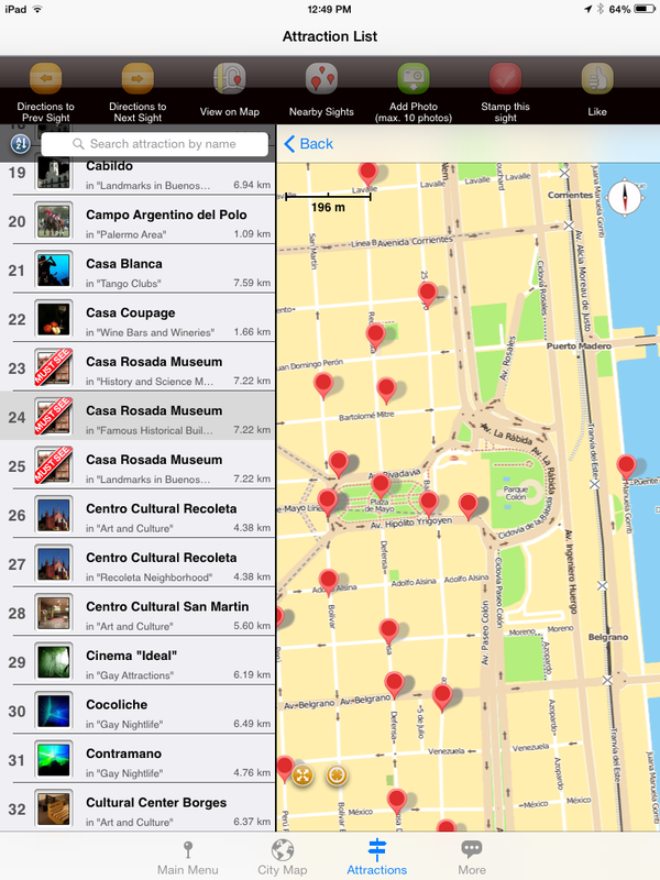
Subway lines and other transportation are also marked on the map, which make it a particularly handy tool to use if living in the city for longer periods of time.
I will confess that I did not find this app particularly intuitive, but I believe this is actually a testimony to its strength rather than a weakness -- I think this app is not some cheap, simple game/toy, but rather, a powerful tool to help one navigate the city in depth.
The boys and I will be spending more time to familiarize ourselves with Buenos Aires Map and Walks, and I would not hesitate to reccommend this app or others by GPS My City.
The boys and I will be spending more time to familiarize ourselves with Buenos Aires Map and Walks, and I would not hesitate to reccommend this app or others by GPS My City.
 RSS Feed